TAPAS.network | 23 April 2024 | Commentary | John Dales
Sidewalk stories from the Big Apple. What makes a city special - and worth fighting for
Looking at other countries, cities and cultures can teach us a lot, and give us a new lens through which to examine how we live and work ourselves, says J. Just back from the USA he reflects on some of the forces that shaped New York, and the dangers of chasing future visions that miss the fundamentals of what really matters.
WHAT IS IT ‘they’ say about travel? That it broadens the mind? I prefer the version of this saying that’s attributed to G K Chesterton: “They say travel broadens the mind, but you must have the mind”.
Last week, I spent a few days in New York, at the end of what had been a road trip through a handful of the United States: North Carolina, Virginia, Maryland, Pennsylvania, New Jersey and New York itself. I’m sorry to have to talk about a ‘road trip’ in a column that’s usually about streets, but there’s plenty about streets to follow. This journey was occasioned by a family wedding in Durham, NC and – in addition to being thoroughly enjoyable – exposed me to a wide variety of new experiences, of alternate versions of old experiences, and of others’ histories, cultures and lifestyles. All of which prompted numerous questions, different avenues of thought, and a range of reflections; some of which I am about to regale you with.
Those who know my work and writing will guess (correctly) that it was the big cities we visited – Washington DC, Philadelphia and New York – with which I was most fascinated; and those same students of my thinking will also be unsurprised to learn that some of it this time was prompted by the music I listened to as the trip unfolded.
Before I start in earnest, I confess I’m one of those prone sometimes to taking cheap shots at ‘Americanisms’, and I’m not sure I’ll ever quite come to terms with the fact that ‘chips’ over there means crisps, or that they call scones ‘biscuits’. However, to redress that balance, let me put on the record my opinion that ‘sidewalk’ is a much better term for the place where people walk at the side of streets, than the British word ‘pavement’, or even ‘footway’. There, I said it.
Now starting in earnest, I’ll begin by stating my conviction that life and work are made rich and fascinating and energising and fulfilling when we are (a) curious, (b) eager to learn, however old we may be, (c) prepared to try and understand others’ points of view, and (d) willing to modify, or at least refine, our own views in the light of what we find. All of which I hopefully was on this trip.
Is it as Road? Is it a Street? No! It’s a...
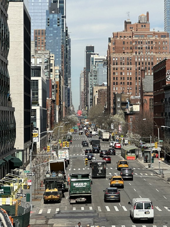
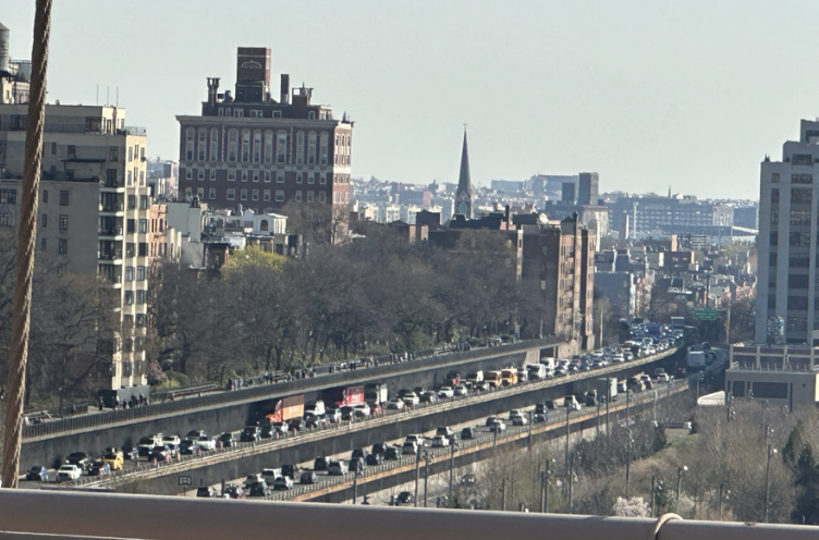
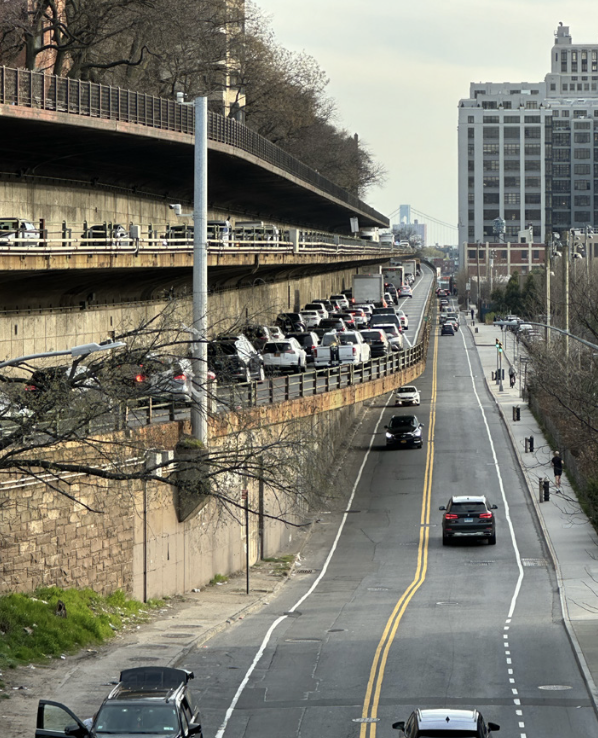
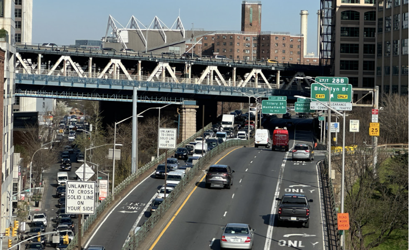
New York: Plenty of street space - but too much dedicated to traffic
American history is full of such re-thinking, re-positioning and sometimes (sadly) retrenching of principles and ideas, arising from the influx of new people and the challenges of how people with different beliefs and backgrounds get along with one another.
How such challenges are resolved is of vital importance, and I was reminded by some of what we did and learned on this trip about how the American Civil War - four years of appalling loss and destruction from 1861 to 1865 - was fought, not for territorial expansion, but over differences of culture and belief pivoting around the matter of slavery.
The soundtrack of the musical Hamilton was part of the backdrop to the road trip, and I have always been struck by how this story of one of the Founding Fathers features three duels, fought over honour or principles, for which the chief actors on both sides could find no better means of resolution. At the risk of grossly over-simplifying matters, the Civil War can be viewed as a ghastly duel, which resulted, it is estimated, in the loss of three quarters of a million lives. Utterly tragic.
The song We Americans, by The Avett Brothers, was also on our US playlist. In my opinion, it’s a wonderfully thoughtful and nuanced reflection on holding love for country in tension with knowledge of how that country was shaped - “a place built on stolen land by stolen people” through “the arrogance of manifest destiny”. It also includes the line, “I’ve been to every state and seen shore to shore the still open wounds of the Civil War”, and this can be seen at work in much of the increasingly polarised and febrile character of current US political and social media discourse. I’m right; you’re wrong. I’m Us; you’re Them.
The same spirit is at large in our own contemporary politics and culture, of course. However, the whole idea of asserting we’re ‘right’ – and holding hard to that line – denies us the opportunity (and I would say privilege) of exploring, of learning, of engaging, of being challenged; and thereby of changing and of becoming better and of doing better. It’s not that there aren’t some principles we should not hold fast to (and, for the record, I’m very much on the abolitionists’ side over the matter of slavery), but it is that we should bring understanding, empathy and a lack of dogmatism to the table if we really want to make positive change.
As I’ve said here previously, these are traits that should be considered central to our work as transport practitioners, or planners or urbanists. And, at the mention of ‘urbanist’, it’s time for me to skip past Washington DC and Philadelphia (absorbing though both were, in quite different ways) to reach New York, the city where urbanist Jane Jacobs lived between 1935 and 1968. She was the author of The Death and Life of Great American Cities, published in 1961 and about which I agree with Wikipedia that it “remains one of the most influential books in the history of American city planning”. If you haven’t read it, I urge you to do so.
One of the things on my New York ‘to do’ list was to go to the house in Greenwich Village in which Jacobs lived from 1947 to 1968, where she wrote her magnum opus, and from where – in the 1950s - she helped orchestrate opposition to New York city boss Robert Moses’ plans to demolish Washington Square Park for a new highway. If Moses’ name means nothing to you, he was an urban planner and public official who, from the 1920s to the 1960s, and without ever being elected to any office, became arguably one of the most powerful and influential people in the city’s history. Perhaps surprisingly, he was recently the subject of David Hare’s play Straight Line Crazy, which I went to see in London with colleagues in 2022. If you want to find out more about the man and his impact, you could try Robert A Caro’s book, The Power Broker.
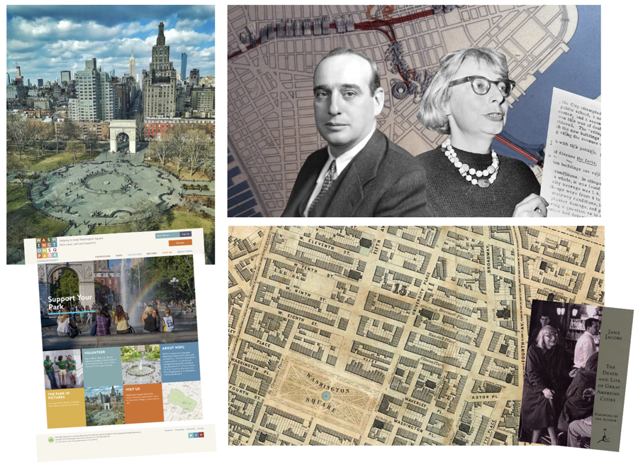
The battle for Washington Square Park (below left) was fought between city planner Robert Moses and urbanist campaigner and author Jane Jacobs (below right). Since her victory over his road plans in the 1960s, the square has become a much loved open space with its own website and friends organisation (bottom left).
In his early years, Moses was strongly motivated by the desire to improve the lives of ordinary New Yorkers, and strove to create a variety of new parks where working people and their families could spend their leisure time in the outdoors. To enable access to these parks, and for other reasons, however, he was responsible for building over 600 miles of expressways, and several bridges; but almost no infrastructure for mass transit. His vision of the city, in common with the views of others then and since, was one dominated by the primacy of movement by car. He thought he’d seen the future of cities, and wanted to help it happen; with the destruction of some neighbourhoods seen as justifiable in order to enable roads carrying cars to move to and fro. By the 1950s, opposition to this ideology had started to build, and Jane Jacobs was a leading actor in that resistance. She’d seen Moses’ future too, and didn’t like the look of it at all.
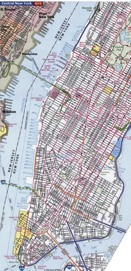
I’ll tell you more about the Washington Square Park episode shortly, but while I have straight lines and roads in mind, let me quickly tell you something about Manhattan island’s famous grid system that I always find diverting. You may know that, in general terms, the north-south streets in Manhattan are ‘Avenues’ numbered from east to west, starting with 1st Avenue and reaching 11th Avenue. Similarly, the east-west streets in the grid are ‘Streets’ numbered from south to north, starting with 1st Street and reaching – I think – as far as 263rd Street, way north of Manhattan in The Bronx.
In truth, this is of course another over-simplification, with the east-west numbering only starting north of the pointier southern part of the island, and the grid system itself falling apart once you get a bit north Harlem. In the central part of Manhattan having the purest expression of the grid – the roughly two-mile-long stretch of the island south of Central Park - the numbering of the north-south streets stops at 3rd and picks up again at 5th. In between, there are three streets, not one, and none of these are 4th Avenue. From east to west, they’re Lexington, Park and Madison Avenues. I love the fact that such an inherently navigable – if very dull – street naming system just stops making sense for no obvious reason. Maybe it’s simply to catch tourists out, or – in my case – entertain them.
In case you’re wondering, there is a 4th Avenue, but it’s just a remnant of around 700m, between 6th St and 14th St. It did once go further north, but that bit is what is now named Park Ave.
Another stone in the pond of the classic grid is the famous Broadway, which runs diagonally through central Manhattan and, in doing so, creates some strange triangular spaces. One of these spaces is the location of the famous Flat Iron Building, named for its triangular shape, at the junction of Broadway and 5th, and another is Times Square, at the intersection of Broadway and 7th. There’s a certain charm in having some of these oddly-shaped public spaces, but there’s no denying that triangular plots are harder to use well than more rectilinear ones, and it can be difficult to cross the junctions at their apices/apexes on foot. Washinton DC has quite a number of diagonals, resulting in far too many under-used and inhospitable spaces and junctions.
If you’re ever building a city’s street system from scratch, please bear this in mind.
My time in New York reminded me of something else, and this may perhaps be of greater relevance to the work and interests of my readers. It’s the fact that New York’s population density is around twice that of London’s. According to figures I have just looked up, the total residential population of the two cities is about the same (currently a little above or below 8.5 million people), but the land area over which those people are distributed is about twice in London what it is in New York.
New York’s famous grid street system. Robert Moses sought to accommodate growing traffic in the 1950s and 60s by squeezing in additional elevated stacked freeways.
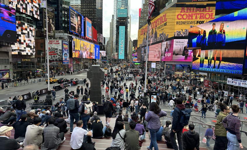
What’s the best use of urban space? Elevated freeways in New York (left) and the now pedestrianised triangular open space of Times Square, at 7th and Broadway (right)
Though not (I think) in these pages, I have frequently remarked on the fact that population density seems never to crop up in discussions about how people move around cities, and specifically about what are the most efficient and effective ways to enable people to do that moving. The sheer number of people trying to move per unit of space should surely be something we ought to give a great deal of thought to, no? Because, unless I’ve missed something all these years, one of the hardest challenges to resolve in city planning is how best to use that city’s space, including its street space.
You are, I’m sure, familiar with those composite images comparing how much space a given number of people take up if they’re in cars, buses or on cycles (see an example below). However, this line of thinking rarely, if ever, seems to get beyond making the general point; and even this point seems most commonly to be made in the context of cycling being shown to be more space-efficient than car driving; or buses (when full) replacing at least a couple of dozen cars. But what does space efficiency mean in practice in the planning of cities, transport networks, and streets? This is not a question I can attempt answer on this occasion, but l will just add a related reflection that arose from a visit I made, a couple of years ago, to the most populous city in Europe, Istanbul.
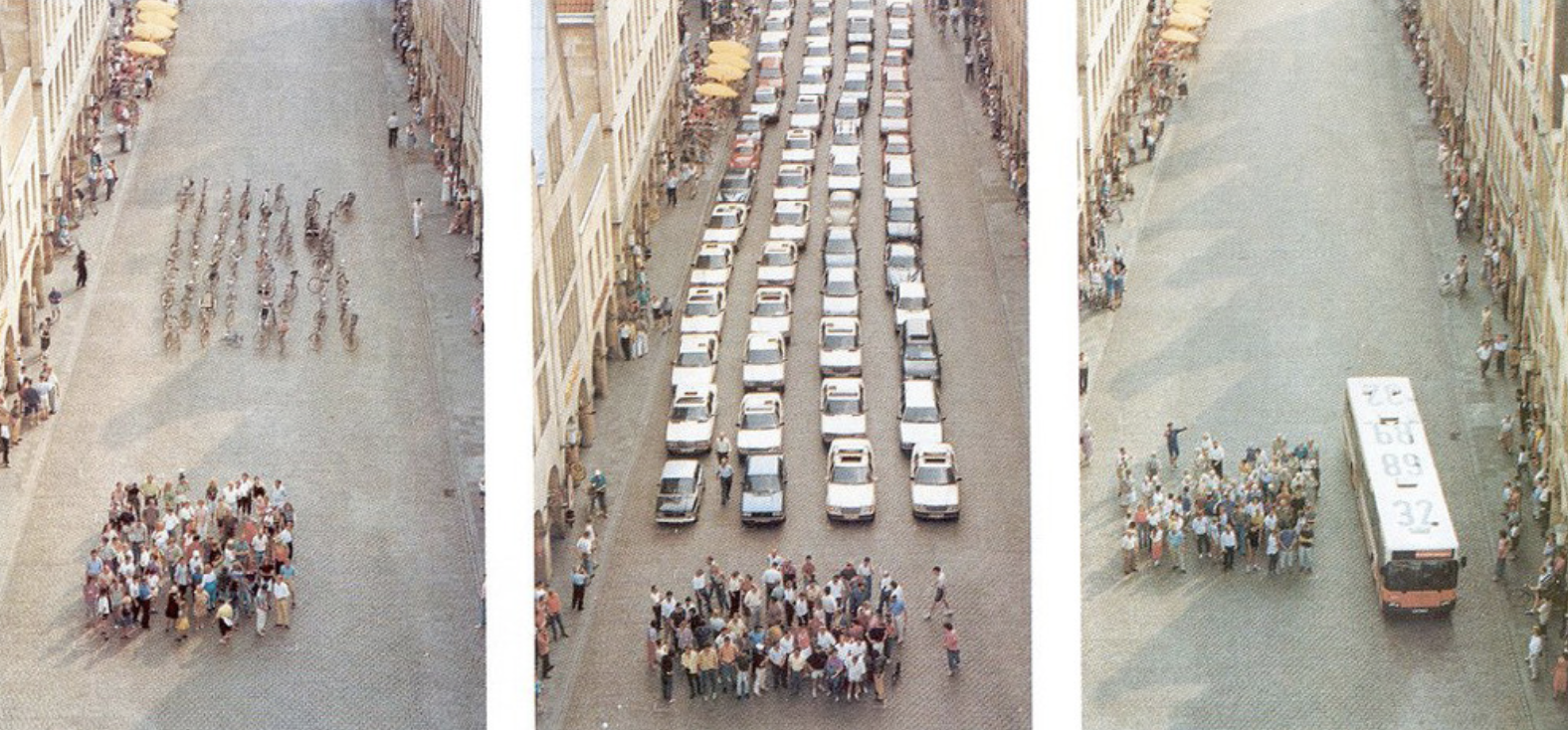
Dramatically demonstrating the space consumption of different transport modes
The overall population density of that sprawling Turkish city is considerably below London’s, but the demand for space in its central areas is huge, arising at least partly from the fact that it’s the daytime populations of the busiest parts of cities that can represent the biggest challenges in terms of moving people. At one point I took a few moments to observe a particular street that was crammed with traffic: a four-lane single carriageway. I noticed that virtually all the vehicles creating the congestion were some form of public transport: many (single-deck) buses, plus ‘dolmus’ mini-buses (shared taxis) and regular taxis. The vast majority of these vehicles, to my eye at that time, were full; mostly packed. In other words, the available street space in that location was being used very efficiently. Partly also due to the generally hilly nature of that part of the city centre, and to the many very narrow and steep streets near that big street, the thought that made its way to the front of my mind was “This is not a part of the city where cycling can make an appreciable contribution to meeting the people-moving challenge”.
I may have been wrong, yet again, but the core issue this reflection raised was that we need to avoid being dogmatic about what the best transport responses might be to the issues encountered in any given context; and this must relate to clarity about needs and outcomes. We need to be thoughtful about it, not just assume that what we’ve seen work well elsewhere will inevitably best meet the needs here; or indeed that what makes us feel better about the city is actually necessary or good value for money. There seemed, for example, a good deal of deep metro works under way and planned in Istanbul, but it’s not clear to me how or if they will deal with the pressing issue of central area congestion and the associated highly unpredictable journey times that ordinary people face. But that’s another story.
Returning to my reflections on New York as I begin to close, one of the things that struck me most about my three days walking, cycling and taking the subway around Manhattan and Brooklyn was that I have yet to encounter a city where fewer cars wouldn’t make everything a great deal better – for literally everyone, including those who really need to drive. This is because, as Robert Moses seemed not to grasp, the means of movement we prioritise should help make the city a better place to live in, work in, trade in, be in and enjoy.
As another American, Taras Grescoe, wrote in his book Straphanger, “Even if a zero-emission miracle-car, running on tap-water and yielding only lavender-scented exhaust, appeared in dealerships tomorrow, it would not solve the fundamental problem: The automobile was never an appropriate technology for cities. As a form of mass transportation for the world, it is a disaster.”
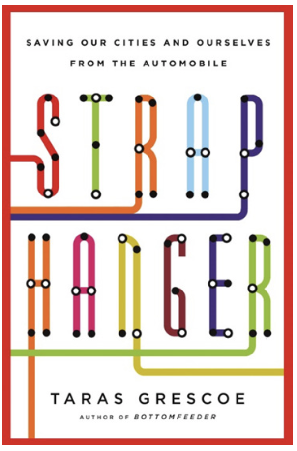
Taras Grescoe’s book about resisting te dominance of the automobile in cities
Although I forget whether Grescoe mentions the man by name, it’s hard to avoid the feeling that the following summary is aimed at people with views like Moses had:
“This book is, in part, the story of a bad idea: the notion that our cities should be shaped by the needs of cars, rather than people. By diminishing public space, the automobile has made once-great cities terrible places to live.”
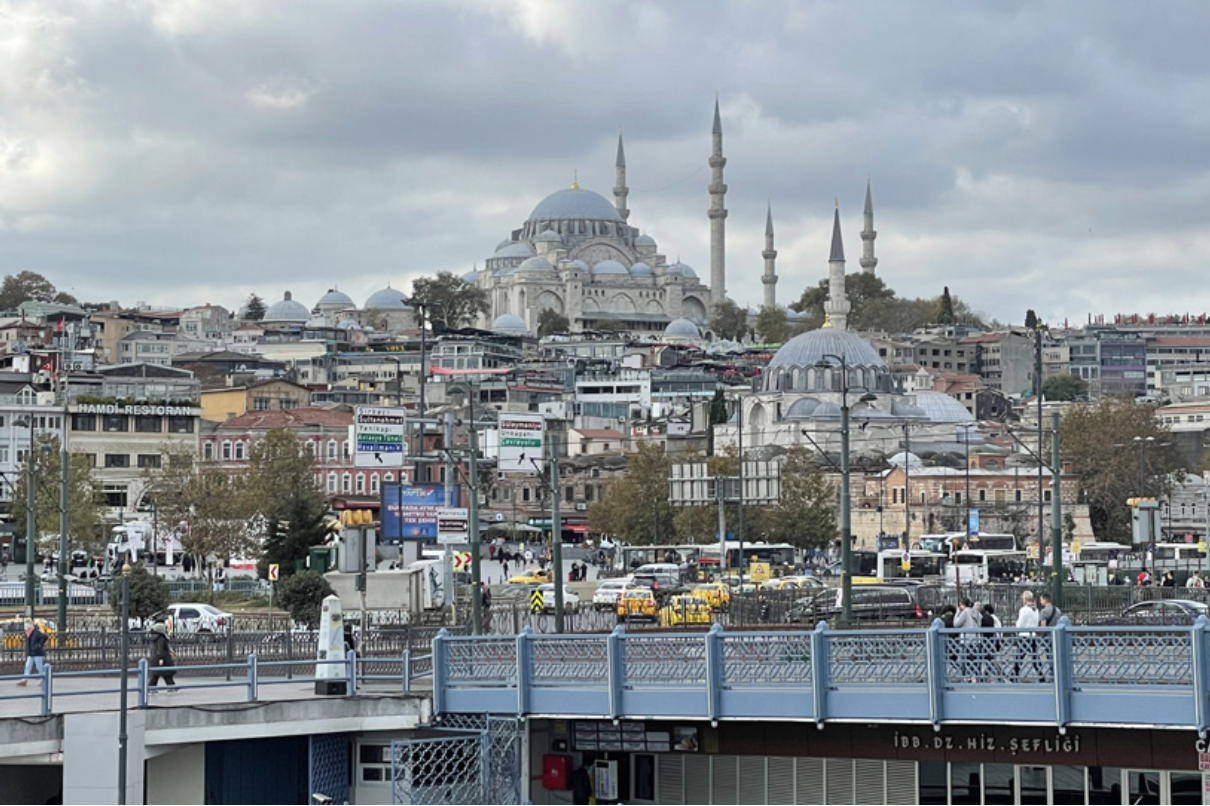
Istanbul: Its central area is unsuited to traffic and now subject to regular congestion.
This is a theme and a view with which I’m sure Jane Jacobs would have concurred; and it brings me back to Washington Square Park. What Jacobs and others were objecting to in that location was a new north-south highway (a southwards extension of 5th Ave) that would form a T-junction with another proposed highway that would directly link Brooklyn (to the east, via two existing bridges), across lower Manhattan, with New Jersey (to the west, via the Holland Tunnel). The anti-expressway campaign was successful, neither of these new highways were built, and Moses’ grip on the city was substantially loosened, never to be re-tightened.
We walked through, and stayed for some time, in Washington Square Park, on a lovely spring day on which it happened that a near eclipse was to be seen from the city. Because of all the tall buildings in Manhattan, spaces from which to see this phenomenon were at a premium, and Washington Square Park is one of the largest public spaces in the city (the giant Central Park being another matter altogether), and even has its own website: washingtonsqpark.org. Whether the eclipse had drawn more people than usual to the park when we were there, I cannot say, though we preceded the event by at least two hours. What I can say, though, is that it felt as though all of Manhattan’s people were represented there. People from a wide variety of backgrounds and walks of life walking, chatting, playing music, selling things, skate-boarding, strolling, reading, looking around, making films…
Washington Square Park, as I experienced it, was a marvellous example of something it is vital we do not lose sight of when thinking about cities. Alongside all the serious stuff that can be counted, much of which is undeniably important, if cities are not enjoyable, if the residential and daytime populations are denied public space in which to mix, meet and experience the amazing diversity inherent in those populations, if cities cannot truly be lived in as places that are pleasing, interesting and stimulating we have surely missed the point of them.
I’ll finish by referring to a happy coincidence that also arose from my being curious and open to new things. While still in North Carolina, we spent a couple of hours in the small town of Hillsborough. Being officially ‘historic’, there were a number of plaques about the place telling us about important people and events from the town’s past. One of these featured a certain Billy Strayhorn, for whom I also came across a mural. I had no prior knowledge of Billy, but it turns out that he lived in Hillsborough as a boy and later wrote Take the ‘A’ Train, which became the Duke Ellington Orchestra’s signature tune and – of course – made it onto our road trip playlist. At the end of that trip, having dropped off the car, guess what train took us into Manhattan.
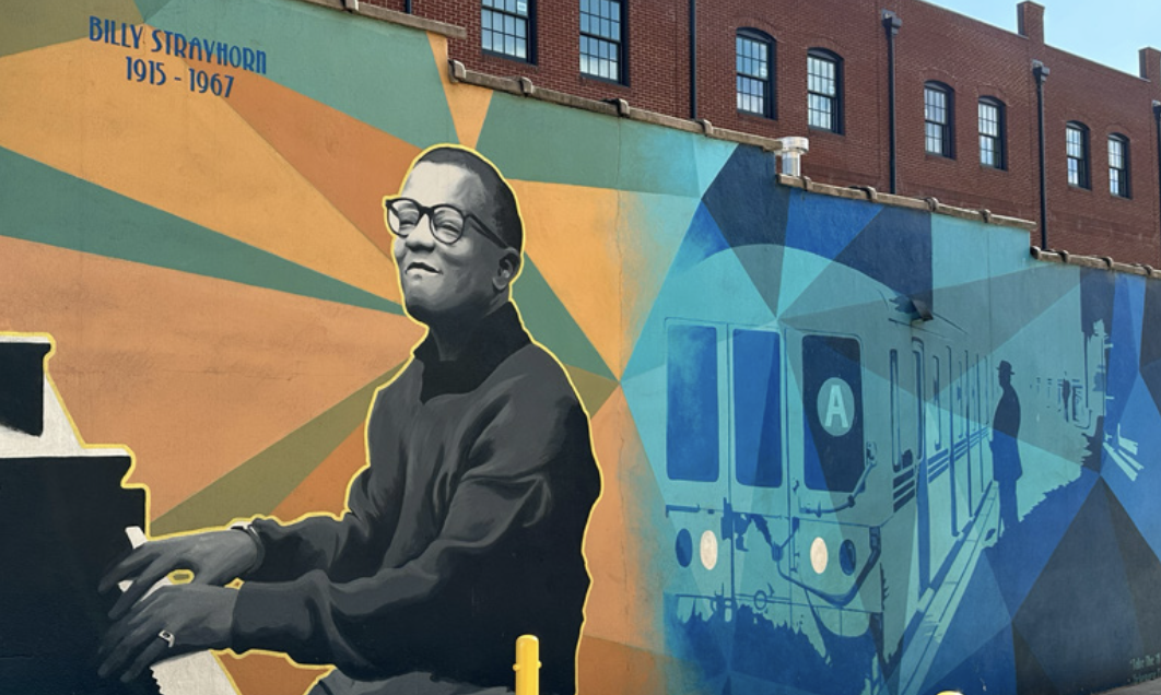
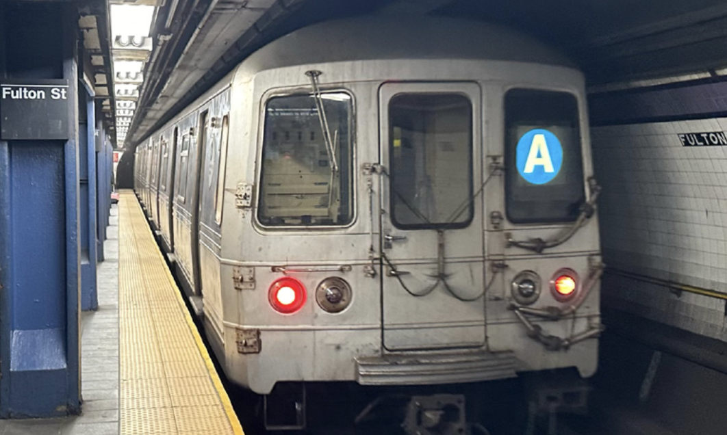
Billy Strayhorn wrote the famous jazz song ‘Take the A train’. John Dales both visited his home town and made the train ride during his US trip.
John Dales is a streets design adviser to local authorities around the UK, and a member of several design review panels. He’s a past chair of the Transport Planning Society, a former trustee of Living Streets, and a committee member of the Parliamentary Advisory Council for Transport Safety. He is director of transport planning and street design consultancy Urban Movement.
This article was first published in LTT magazine, LTT890, 23 April 2024.
You are currently viewing this page as TAPAS Taster user.
To read and make comments on this article you need to register for free as TAPAS Select user and log in.
Log in