TAPAS.network | 14 June 2022 | Commentary | David Metz
Digital Navigation is driving traffic in new directions – we need to respond

Road users are changing their behaviour based on what their satnavs tell them, but the implications are not yet being recognised by those responsible for planning and operating the network, says . He urges more attention to both the negative and positive consequences, with greater collaboration between the interested parties to the benefit of users and society alike.
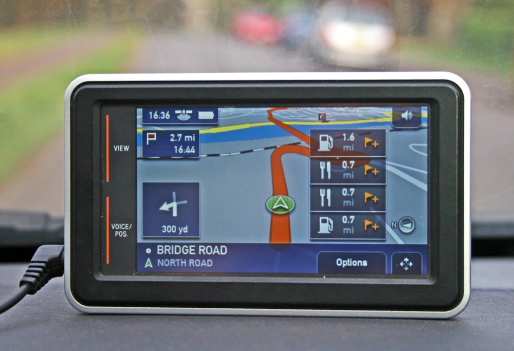
DIGITAL NAVIGATION, generally known as satnav, has become a key feature of the transport system over the past decade. But its implications for both user behaviour and network operation have yet to be fully grasped. The technology has synthesised Global Positioning System location, digital maps and routing algorithms, which together provides turn-by-turn route guidance to road users that both calculates optimum routing and takes account of system disruption and traffic conditions. Such route guidance - provided by Google Maps, Waze, TomTom, Garmin and others - is now in wide use and therefore must surely be changing travel behaviour significantly: if not, why would we use it? Yet there is remarkably little evidence for what is actually happening. The providers are secretive, while those responsible for the road system – both its operations and statistical monitoring of usage – seem to be in a state of denial about its existence and impacts.

There is remarkably little evidence for what is actually happening. The providers are secretive, while those responsible for the road system – both its operations and statistical monitoring of usage – seem to be in a state of denial about its existence and impacts.
The main point of Digital Navigation is to offer routes with shorter journey times than any human driver could calculate. There is some evidence for a resultant consequential redistribution of traffic. A review by the Department for Transport’s statisticians found a 26% increase in traffic on minor roads between 2010 and 2019, compared with a 12% increase on major roads (see LTT 19 March 2021). While growth in van delivery movements would be a contributing factor, the main reason is most likely to arise from Digital Navigation, which makes possible use of minor roads by those without local knowledge. The biggest impact is likely to have been near congested major roads where minor roads offer alternative routes. Those delivery vans, incidentally, are themselves major digital navigation users and are adopting significant new road use patterns as a result.
Such increased traffic on minor roads runs counter to both the Department for Transport’s targets for reducing accidents, to which such roads are more susceptible, and its support of active travel, for which such roads are well suited. It is also inconsistent with the DfT’s encouragement of Low Traffic Neighbourhoods, intended to block rat-running through-traffic.


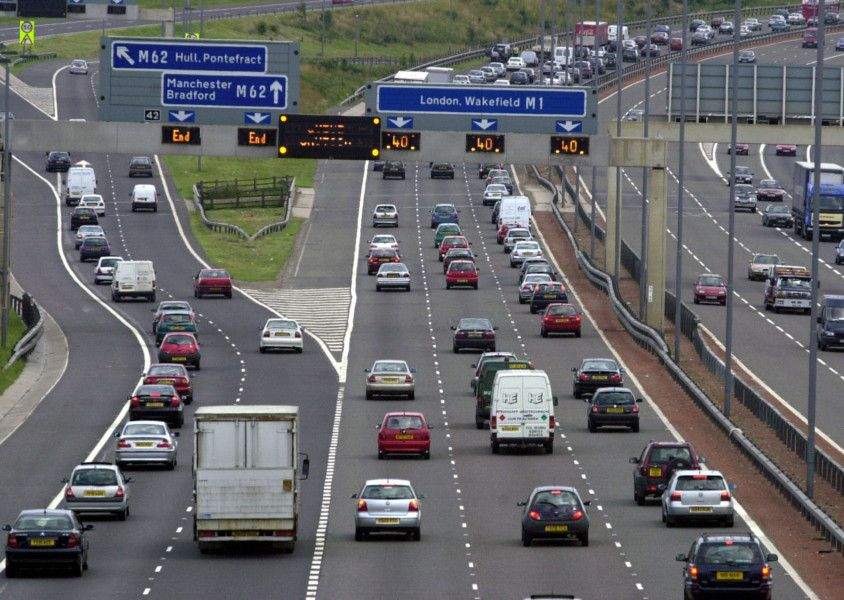
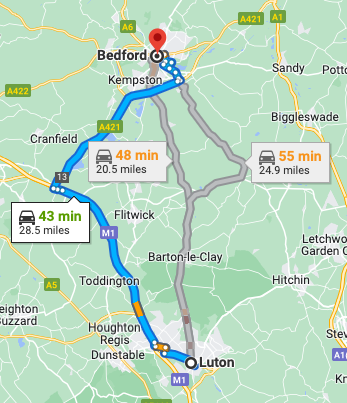
Another type of traffic redistribution facilitated by Digital Navigation is to divert local trips to take advantage of increased capacity of major roads, such as Smart Motorways. Digital Navigation makes apparent to local users the opportunity for faster journeys despite travelling more miles via using sections of motorway, for which the principal purpose was not ‘short hop’ trips. In terms of overall user economics, the time saving is offset by increased fuel costs, and for society by increased carbon consumption and pollution. This is illustrated by my screenshot from Google Maps showing that a journey on the direct route between Luton and Bedford of 20 miles was predicted to take 48 minutes during the morning peak traffic, whereas the 8 miles longer route, via the M1 Smart Motorway between junctions 10 and 13, took 5 minutes less.
Diversion of local traffic that takes advantage of additional capacity on the motorway means less capacity available for longer distance business users – freight and personal -, which is the principal economic justification of such investment. In the case of the M1 J10-13 scheme, the five-year post-opening evaluation found that traffic flowed more slowly compared to before the scheme was implemented, so the outturn benefit-cost ratio was negative.

A review by the Department for Transport’s statisticians found a 26% increase in traffic on minor roads between 2010 and 2019, compared with a 12% increase on major roads.
More generally, evaluation of road investments limited to just measuring total traffic volumes and speeds is inadequate since the composition of the traffic is crucial to the economic justification - the more local use there is, the worse the economic case. Fortunately, data collected by Digital Navigation providers such as TomTom makes possible aggregated origin and destination analysis, which can permit a distinction between local and long-distance users. Use of such outturn information would also allow the calibration of traffic models to be improved, so that future forecasts are more fit for purpose.
One unambiguous benefit of Digital Navigation is the forecast to users of their journey times. This reduces journey time uncertainty, which evidence suggests to be the aspect of road traffic congestion that most bothers road users. Given that we know from experience that capacity increases do not make it possible to build our way out of congestion, so Digital Navigation now seems to be the obvious means available to mitigate its impact.
Performance of Digital Navigation is itself a dynamic matter, as it can be improved through application of Machine Learning, a form of Artificial Intelligence, to analyse data from road users. The leading proponent of this technique is the British business, DeepMind, which came to fame when its algorithm that learned to play the boardgame Go beat the world champion. DeepMind was acquired by Google in 2014, one aim being to apply Machine Learning to the vast quantities of data generated by Google’s businesses.
One application has been to achieve measurable useful improvement to predicted journey times offered by Google Maps. This involved the application of Machine Learning to huge amounts of data that specifies trip origins and destinations, routes on network, traffic conditions, and predicted and outturn journey times. The process identifies the determinants of journey time accuracy and thereby improves the performance of the travel behaviour model constructed from trip data. This approach is also likely to be of general application to improve the operational performance of the transport system.
Such features raises questions about the future of both conventional transport modelling and established control room and signalling calibration technology for those that manage the highway system.
Another consequence of the redistribution of traffic across the road network facilitated by Digital Navigation may be to reduce traffic levels on the most congested routes at peak times. This flatter spreading of traffic is a potential step towards more optimal network efficiency, albeit qualified by the concerns I have mentioned about the suitability of minor roads for carrying more traffic.
A question that arises from the scenarios I am here exploring is whether some oversight of the providers of Digital Navigation services and coordination of their messaging with those who provide and manage the highway network could achieve further efficiencies, and reduce unwanted consequences, both under normal operating conditions as well as at times of stress – bad weather, major incidents, and peak daily and season flows. Such oversight would require that the providers be regulated and have a duty to share their knowledge and algorithms.
There is in fact legislation on the statute book to regulate Digital Navigation - the Road Traffic (Driver Licensing and Information Systems) Act 1989, which requires route guidance systems that take account of traffic conditions to be licenced by the Secretary of State. The intention of the legislation was to facilitate the introduction of a pilot route guidance system that had been developed by the government’s Transport and Road Research Laboratory, although in the event this was not taken forward. In practice this legislation has been disregarded as no licences have been issued. If implemented, the licence could include conditions concerning the roads that should not be included in route guidance, and provision to road authorities of data on traffic conditions.
The scope for achieving a more operationally efficient and environmentally less detrimental road network by fully embracing digital navigation within the management system, rather than leaving it as an external commercial service to users, is clearly worth studying. Yet any real prospects of taking advantage of Digital Navigation for these purposes depends on overcoming the elephant-in-the-room phenomenon – getting all those with responsibilities and interests in the outcomes to recognise the potential and come to the party.
Roads policy and practice is still very focused on civil engineering works – funding, planning, justifying, contracting to get them built, and then measures to keep them in good order. Plus, the traditional view of traffic engineering as markings, signage and signals and the like. We are midway through the second Road Investment Strategy investment programme worth £27 billion over five years, spread across a large number of schemes. While some of this expenditure is for capital maintenance, the greater part is devoted to new physical capacity. Given the high cost of civil works, lane-miles have barely increased faster than population growth in recent years, and the environmental and resource consequences are very substantial.
Contrast this with aviation. Airports of course bring major civil engineering projects including runways and terminal capacity. Yet the main focus of the aviation sector is to improve operational efficiency, minimising fuel and other costs, maximising aircraft utilisation and passenger load factors and the best possible handling of flows of passengers and baggage. Less conspicuously, air traffic management optimises use of crowded airspace. The underlying discipline is not civil engineering, but operations research and financial and commercial yield management.
The relationship between airlines, airports and air traffic control is thus an interesting one – and very different from the world of roads and their use. I do not suggest directly mirroring aviation, but I do think we should pursue operational efficiencies and optimal asset use through a re-orientation from investment to operations, from civil engineering to digital technologies, and by a suitable structure for the various parties to interact and integrate their objectives and activities. These could include embracing the Net Zero climate change objective, including factoring down both tailpipe emissions and embedded carbon.
It is worth noting that the one class of road user for which operational efficiency through digitisation is of central importance is road freight operators, often part of integrated logistics businesses. They are proficient at fleet management using digital technologies, and at delivering goods in time slots, the progress of which both despatchers and recipients can track. This experience could usefully be brought to bear on the totality of traffic flows across the road network as operations-oriented leadership takes advantage of the large data flows now available, including those from users of Digital Navigation, and the opportunity to shape a guiding mind for the road network that meets current economic, environmental and social priorities.
The full paper on which this article is based is available at https://bit.ly/3NqBiFu
David Metz is an honorary professor in the Centre for Transport Studies, University College London, where his research focuses on how demographic, behavioural and technological factors influence travel demand. He spent part of his career as a senior civil servant in a number of UK government departments, both as policy advisor and scientist, including five years as Chief Scientist at the Department of Transport. www.drivingchange.org.uk
This article was first published in LTT magazine, LTT847, 14 June 2022.
You are currently viewing this page as TAPAS Taster user.
To read and make comments on this article you need to register for free as TAPAS Select user and log in.

Log in