TAPAS.network | 8 August 2022 | Commentary | Phil Goodwin
How best to use Road Space:
a problem we can’t ignore, but it’s a multi-dimensional and complex one

An increasingly competed over and valuable resource, road space usage is poorly understood, unfairly allocated, misused and abused and subject to influences that are complex and dynamic and go well beyond conventional transport considerations, says . Here he sets out the case for a long hard look at the subject, and some of the factors that need to be taken into account.
THE SUBJECT I EXPLORE in this column started off as a research proposal. It seems to me a very important one. There are probably four or five PhD theses in it (or one extraordinarily good one), or it could be the basis of a well-informed advisory committee commissioning evidence in the public interest. The politics are quite complex, so anyone taking up these issues needs to be independent - and brave. They will need to apply several disciplines, including engineering (traffic science and vehicle technology), behavioural modelling, planning law, empirical sociology, political analysis, and a host of supporting knowledge on health, environment, medicine and systems dynamics. To avoid any misunderstanding, it’s not a project I propose myself for, but I’d be pleased to encourage and support anybody who would like to take it forward.
Here is the idea. It is well known that the allocation of road capacity among contending claims is a controversial and central area of transport thinking, and policy, especially
(a) the reallocation of urban central area road space by large scale pedestrianisation,
(b) favouring bus lanes, trams, and sometimes cycle lanes on main roads with high demands for major flows, often radial to and from the town centres, or orbital around them; and
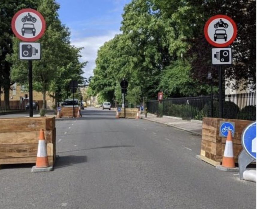
(c) the designation of low traffic residential areas, housing estates or suburban streets, giving more space to local walking and/or cycling networks.
But here I’ll argue there is much more besides.
All the three above objectives constitute a radical change to the thinking that became known as ‘predict and provide’, mostly instead asserting the aims of improving access, efficiency and environment. They have rarely all been implemented at the same time, though there are examples of successes and failures in doing so. Mostly there has been partial attention to one or other of these three strands, nearly always controversial, mostly opposed with the objection ‘where will the traffic go instead?’. Such measures do result in some degree of reduction in traffic overall, especially so in the very largest and most ambitious city-wide schemes. But smaller local initiatives, focussing on just one of the three strands listed above, typically find there is some degree of spill-over of traffic from one street to another. The politics are quite complex, cutting across party lines, and subject to U-turns and splits in the heat of the controversy they invariably play out.
Recent US research shows parking can be substantially greater than the space used for that the urban space used for car housing, a far more significant reallocation of space.
My argument here is that we cannot fully solve or mediate these problems without a major reconsideration and redefinition of the scale and scope of a much wider concept of road capacity allocation. This is because while the controversial local traffic schemes may have the highest profile, they are not in fact the only – and may not even be the main – underlying influences of radical and sometimes extreme changes in allocation meanwhile happening for other reasons.
Partly – and obviously – this is about traffic growth. If the only futures under consideration involve a greater volume of traffic, growing indefinitely into the future, then the creation of oases of calm will inevitably be undermined by the encroaching sands. However, a full statement of the problem needs to take into account not only the three sustainable transport policy instruments listed above, but many other major changing trends, all interacting. Some are policy driven, but others are market- driven, and some are about individual decision and action outside the realm of easily governable choices.
Here is my proposition. The ‘reallocation of road capacity’, generally used as a shorthand for giving some protection to residential areas and main roads from excessive traffic, is just the tip of the iceberg of a very much larger and more complicated process which has accelerated in complex ways in the last fifty years. The overall net effect may be quite different from the aspects which are most apparent in current policy discussions, – and indeed may be the opposite.
Contending claims on space are changing in (at least) the following ways.
-
The size of cars and the space they require
The proportion of the capacity of a road taken up by each vehicle depends on its size. For many years this was taken as a constant, giving a counting method for traffic, passenger car units, PCU, defined as 1 for ‘the average’ car, with other vehicles in proportion to their size and operating characteristics. But car sizes have been increasing very significantly. An increasing proportion of cars have a PCU factor of substantially greater than 1, which means that high levels of congestion or disruption can be experienced even if numbers of vehicles are stable or decreasing. The resulting shift in road space from other purposes to cars, and from small cars to large cars, is probably greater than that occasioned by any specific policy initiatives.
-
The creeping growth of parking space dimensions
A car parked at the kerb will these days encroach more into the rest of the road, sometimes within the comfort zone of the pre-existing marked or implicit lanes. But there is only so far you can go with that, and there are many urban roads which cannot support the wider new cars parked on both sides of the road without taking away lane capacity between them. That means that there is a choice between limiting the movement of other vehicles or having cars mounting the pavement and taking space away from pedestrians. Well-meaning drivers often think they are being considerate by taking space away from pedestrians instead of their fellow drivers. Some local authorities have started to mark pavements and roads to indicate a parking space overlapping both. The reallocation of space between moving and parked cars, and between both and pedestrians, is also probably greater than the effects of other policies. Significantly, the biggest impact in terms of reduction of road capacity for other vehicles is typically made by the first vehicle which parks. After that, the additional effect of one extra vehicle next to it is very much smaller, so there is a ratchet effect which accelerates the process. (Spontaneous chicaning can moderate this effect for a while, but the limit is quickly reached).
-
The changing balance between road space used for traffic (both moving and parked) and that used for other social purposes – chatting, retail, restaurants and so on
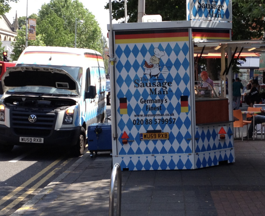
The broader uses of what highway people think of as road space is what a Rees Jeffreys research programme in the 1990s called ‘Streets as Living Space’. This impacts initially on pavements, but swiftly spills over. Some of it is transport-related, but much isn’t. Parking near shops is often assumed to be favourable to business, though many small businesses seem to confuse their own desire for all day parking for the proprietor with multiple short term parking for shoppers. And
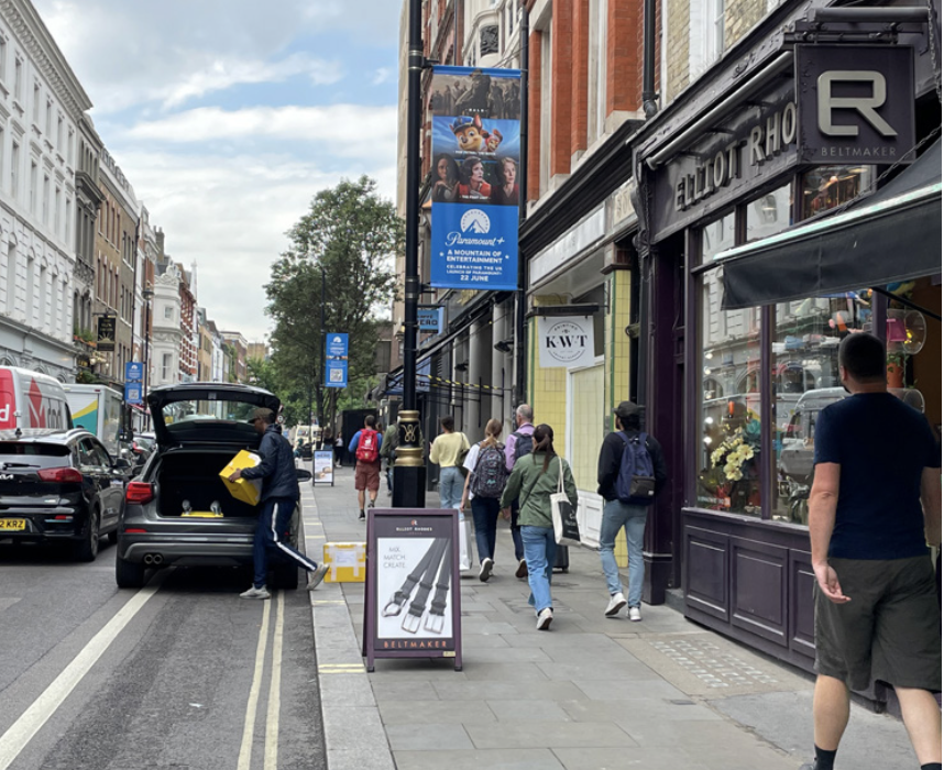
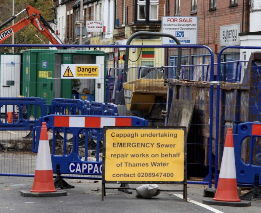
it rarely takes into account the relative spend of car-borne shoppers and those arriving on foot, bicycle or by public transport. Pavement space is also challenged by advertising installations, terminals and cables for electric vehicle charging, the machinery and supplies used for highway maintenance, and by signage, notices and signals. The use of highways’ rights of way for provision of underground services by statutory undertakers – electricity, gas, water, sewage etc. - is also now augmented by telecommunications and digital information equipment. All these require vital access for repairs and maintenance, intermittent but often urgent. Typically, the social disruption of interruption to water supply, sewage or power transmission is very much greater and swifter than interruptions to traffic.
-
The reallocation of space requirements within moving vehicle traffic itself
The interaction of local and long distance movement has been a long-term tension, articulated by Alker Tripp in the 1930s. He specified that there should be a strict demarcation of function, assisted by traffic engineering and planning, so that long distance traffic did not interfere with local functioning, and vice versa. Elements of this were followed in the Buchanan Report in the 1960s, and it is still in principle applied in the different planning processes for ‘local roads’ and ‘strategic roads’, though not in a way which can be distinguished consistently in the traffic quantities used in formal road appraisal. The separation of roads by function actually conflicts with the concept of a whole length door-to-door journey, and the professional driver’s ambition to use all the road space available. Another shift in space has been between private cars and some commercial traffic, especially associated with on-line shopping and home delivery vehicle movements, which can theoretically replace many separate car trips by fewer deliveries by small or large vans, depending on how well the logistics are coordinated. This is a dynamic behavioural process not always perceived at all by those whose decisions have triggered it.
-
The development of Satnav information systems
Satnav use began at a low level in the 1970s and is now close to universal. Satnavs have tended to destroy the protection from excessive traffic of local areas with small scale local road networks that were unknown to drivers from outside the locality. Rat-runs (i.e. the use of residential roads for longer distance traffic) which had previously been unknown or inaccessible, have proliferated by the spread of digitally-delivered awareness of them, and thus become widespread.
-
The evolving planning design of neighbourhoods
A complication to patterns of road use arises from the area of physical planning design of housing neighbourhoods. The Council flats where I grew up in Lambeth were built from the 1920s through to the early post-war years on a lay-out of low-rise blocks surrounding a central yard with limited access and no effective cut through routes. They were therefore quite highly protected from rat runs without the need for further restriction. The road space reallocation which happened in this case was the conversion of the central yard from a rather safe playing area, to increasing use for car parking by the residents themselves. Recently there have been policies to try and reinvent rather more pleasant play areas, with more grass and less concrete. There have sometimes been controversies, but of an entirely different scale from those surrounding low traffic neighbourhoods, which have not had the same historic tradition. However, planning regulations for new developments of housing have provided for streets with more space to be allocated to car parking, limiting the amount available for other activities. Recent US research shows that the urban space used for car parking can be substantially greater than the space designated for housing - a far more significant reallocation of space.
-
The re-use of garages
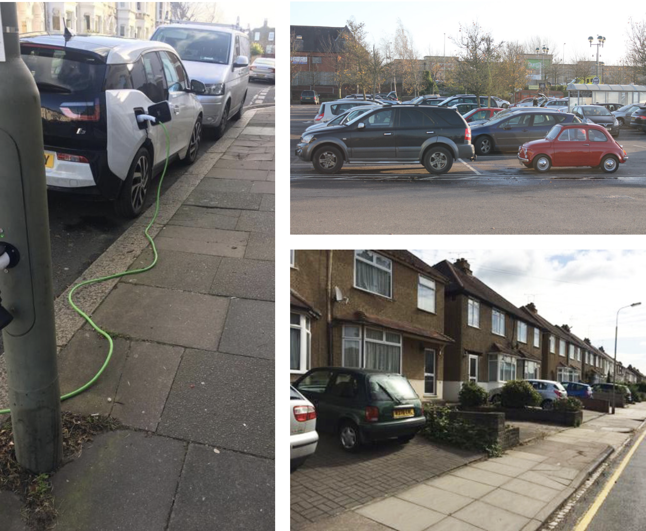
Another design and use change has been that of the integral garages often built as a matter of course in some designs for suburban housing estates, starting in the 1930s and universal by the 1970s. These were all of a size which fitted the vehicle dimensions of those years but is now too small. So, you have the increasing phenomenon of purpose-built garages converted into haphazard store rooms, while front gardens are concreted over to use as parking spaces. And sometimes used by vehicles which are so big that they do not even fit in the concreted garden and overlap the pavement. This has resulted in a four-way shift between house, garden, parking and driving, again probably larger than the effects of any policy, and with significant effects on water run-off and the natural and social benefits of green space. In my case, I have benefited from converting my home’s integral 1970s garage into a fine office where I write this piece.
-
Entitlement beliefs about the kerb space
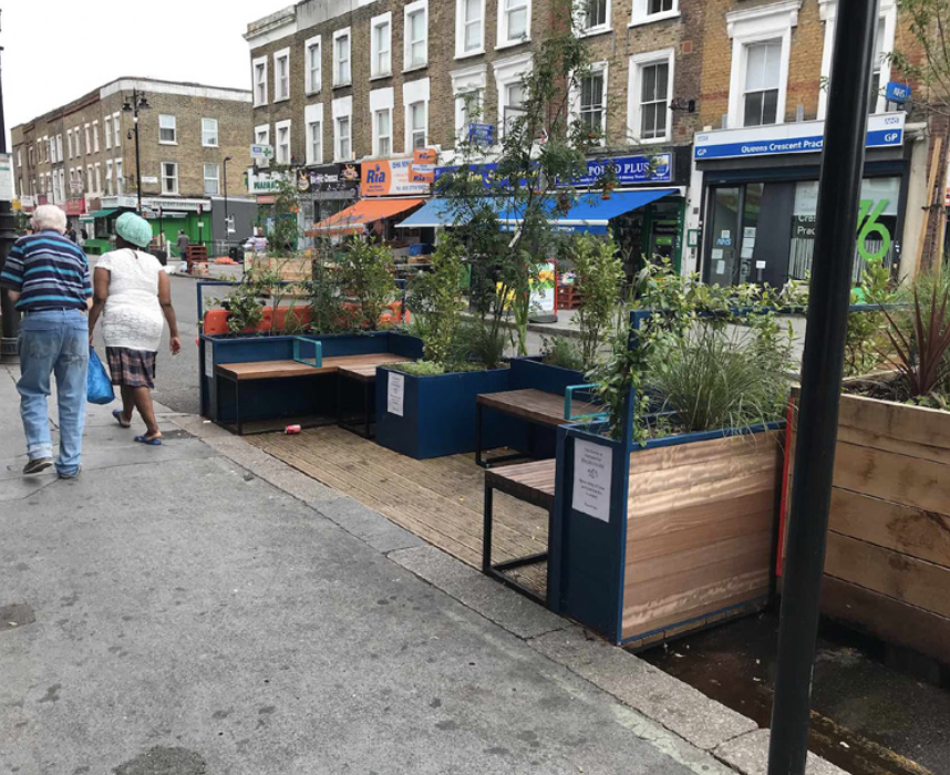
And then there is the influence of a strong ‘folk-law’ approach to property ownership, where the stretch of kerb space spanning the frontage of a house is psychologically assumed to be the private property of the frontager. Even more difficult to convert into real law, is the assumption that you also ‘own’ the stretch of kerb space outside the next-door house if they do not happen to own a car. This may be contrasted with parklets, the concept of using the kerb-side frontage for alternatives to parking, at the initiative of the frontager (usually a business like a cafe or restaurant) or the local authority. The fundamental principle of use of the carriageway for purposes other than moving vehicles is identical, but the perceived legitimacy has been much more controversial. Similarly, designation of traffic control in the neighbourhood of a school runs counter to the individual act of taking the kids to school by car.
-
The arrival of intelligent and autonomous vehicles
A new potential conflict of space has been triggered by the prospect of intelligent or automated vehicles, whose industries and lobbyists have suggested changing arrangements for pedestrian access to cross the road, in the cause of avoiding people and vehicular conflicts and safety, e.g. by the reconstruction of pedestrian barriers, and in order to avoid the dilemma of requiring an automated vehicle to give precedence to pedestrians, or not to, both of which are viewed unfavourably.
-
The defined and assumed rights of different users
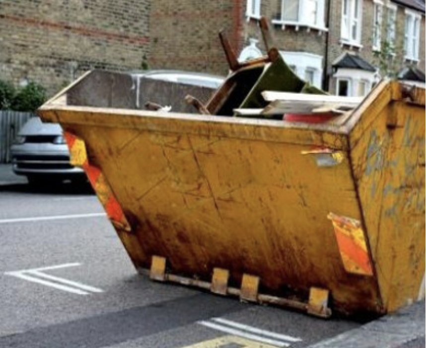
In handling all these contests over space, there are some explicit differential rights or practices for designated categories of users, including an explicit suggested hierarchy now specified in the Highway Code, which is roughly based on vulnerability. But there are other hierarchies defined by law and social practice, for example those for emergency services, police, and disabled travellers. A less well specified hierarchy is the appropriation of special rights by the exercise of power, perceived entitlement, or type of vehicle. Skips, concrete mixers, scaffolders and rubbish collectors have a sort of social sanction to do what they want, as ‘essential’, underpinned by the visible urgency of their task or the imbalance of power, vulnerability, size and strength of their vehicle, and assertiveness of the drivers and their colleagues.
I doubt the above is an exhaustive list, but all these formal and informal claims on space are affected and amended by the structure of prices and regulations, and by the allocation of resources, changing social and lifestyle expectations, the intervention of media and other lobbying, and the urgency of higher-level concerns on climate and party politics. My proposition is that we will make much better decisions if they are informed by evidence on how all these pressures have evolved, and the orders of magnitude of their impact. There is an obviously dynamic equation in play here for a ‘space marketplace’, akin perhaps to the battle for a piece of a crowded beach on a hot day.
My intuition is that the scale of reallocation of road capacity in recent years has been transformed much more – and maybe in the opposite direction – by all these other changes and claimants, compared with the modest policies to improve the public realm and address issues of personal space and safety. But that’s just a hypothesis. The key is to find the evidence.
This major and neglected area of concern is of course more than just about transport. It embraces where we place the role and importance of transport and its impacts alongside all the other activities in the overall order of things. Choices, trade-offs and the distribution of benefits and disadvantages are implicit – and it would surely be better if they were rather more explicit, and thus more clearly described and evaluated. That might lead to the identification of some important, but hitherto unnoticed, policy implications.
I don’t believe, however, that this all means we can’t do anything unless we do everything. That must be rejected. Things get worse or they get better. Climate science, pollution science, and traffic science will all continue to unfold in ways that are independent of the intentions and motives of the actors that influence the overall equation. The ‘allocation’ issues affect all of these, and therefore economic efficiency, equity, resilience, protection, benefit and harm.
Phil Goodwin is Emeritus Professor of Transport Policy at UCL and UWE, and Senior Fellow of the Foundation for Integrated Transport.
This article was first published in LTT magazine, LTT851, 8 August 2022.
You are currently viewing this page as TAPAS Taster user.
To read and make comments on this article you need to register for free as TAPAS Select user and log in.

Log in